


Winter impact: the low pressure system that will test the Uruguayan coast
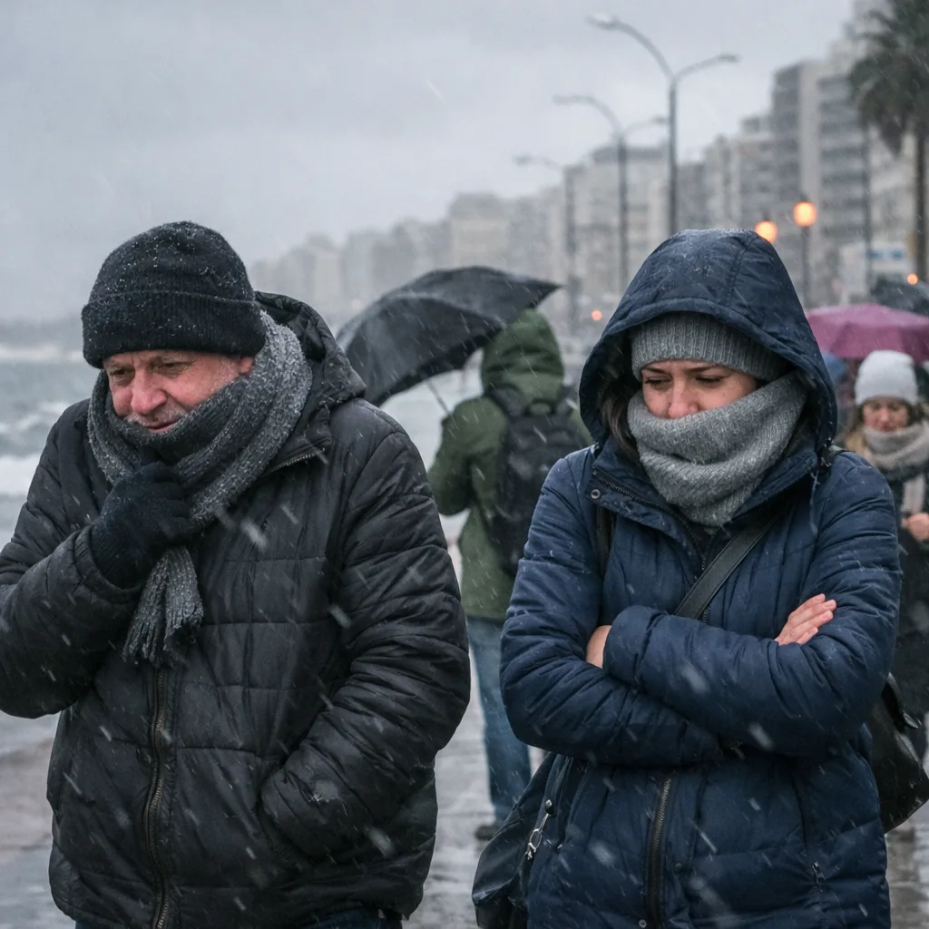
The climatic scenario in the Río de la Plata is undergoing a radical metamorphosis. After a week marked by instability and severe storms in the north of the territory, the arrival of a extratropical cyclone in Uruguay It promises harsh winter conditions for the next few hours. According to the analysis of experts in the field, the phenomenon will move from this Thursday, bringing with it a marked drop in temperature and gusts of wind that could generate complications in the infrastructure of several departments.
The axis of the storm: areas of the southeast under maximum gusts
The technical reports emphasize that the highest intensity of the wind will be recorded in the southeast of the country. The coastal departments of that region are in the eye of the system, with projections of gusts that would reach 100 km/h. However, the radius of action of the phenomenon is not smaller for the metropolitan area; the capital and surrounding areas will experience considerable gusts that warrant extreme care on public roads and securing objects that may be moved by the force of the air.
This abrupt change in atmospheric dynamics is due to the withdrawal of a mass of humid air that gives passed to a cyclonic configuration. It was explained that this process will be accompanied by a notable thermal drop. Although this Thursday the maximum temperatures are already around 14 °C, Saturday will be the day with the greatest impact, with an extremely windy atmosphere and thermal sensations that could approach 0 °C in the most exposed areas.
Forecast for the end of the week: sun with frigid air
For those planning outdoor activities this Sunday, the extratropical cyclone in Uruguay It will begin its phase of moving out to sea, allowing the weather to stabilize. Although the sun will be the protagonist in much of the country during Sunday, the atmosphere will remain cold. Maximum temperatures will hardly exceed 15 °C, configuring a scenario that will require winter shelter.
The official recommendation points to constant surveillance. The combination of winds intense and soils that still retain moisture from previous rains increases the risk of falling trees and cuts in the electricity supply due to the movement of cables. The population of the coastal strips is urged to avoid unnecessary circulation in areas of risk while they last the gusts of greatest magnitude.
The science behind the phenomenon
Extratropical cyclones are low systems usual pressure in these latitudes during the transition to winter. However, the depth of this particular system generates atmospheric pressure that accelerates the air masses violently. This process is closely monitored by the competent authorities to adjust the alerts in force and coordinate rapid responses to possible damage to light infrastructure.
Subscribe to Uruguay Al Día
Receive the most important news directly in your email. Clear, independent and updated information every day.
Follow us on WhatsApp
Join our official channel and receive alerts, news and exclusive content from Uruguay Al Día.
🔔 Join the WhatsApp channel


