Mexico under climate alert: heavy rains, extreme heat, and dangerous waves
Extreme weather in Mexico marks this week, with phenomena unevenly affecting different regions of the country. From tropical storms to temperatures exceeding 40°C, the situation demands attention and preventive measures from the population and authorities.
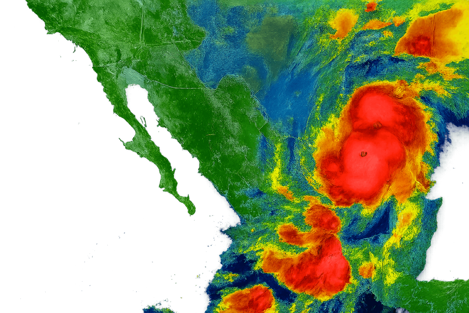
Tropical Storm Narda: Rain and waves in the Pacific
Tropical Storm Narda, located southeast of Michoacán, is generating cloudiness and heavy rainfall in the west and south of the country. The interaction with the monsoon trough and the divergence in altitude are causing rainfall of up to 150 mm in states such as Guerrero, Michoacán, Colima, and Jalisco. Wind gusts of up to 70 km/h and waves that could reach 3.5 meters are also expected on the Pacific coast.
These conditions increase the risk of waterspouts, especially along the coasts of Guerrero and Michoacán, extending toward Colima and Jalisco during the afternoon and evening. Authorities recommend avoiding maritime activities and staying away from coastal areas.
The Mexican monsoon triggers rains in the north and northwest
In the north of the country, the Mexican monsoon and high-altitude divergence are generating heavy rains in Sinaloa and Nayarit. There is also a risk of waterspouts along their coasts. In Baja California, the subtropical jet stream maintains the likelihood of showers, while low-pressure channels are bringing thunderstorms to the center and northeast, with particular intensity in Puebla.
Precipitation in these areas could exceed 75 mm, accompanied by lightning and gusty winds . Caution is advised in urban areas prone to flooding and power outages .
Tropical Storm Narda, combined with the Mexican monsoon and Tropical Wave 34, is causing intense rainfall, dangerous waves, and extreme heat in various regions of Mexico, forcing the public and authorities to take urgent preventive measures.
Heavy rains in the southeast and Yucatan Peninsula
Tropical wave 34, along with an upper-level trough and a low-pressure channel, is triggering rainfall in the southeast of the country. Veracruz, Oaxaca, Chiapas, Tabasco, and Campeche will experience intense rainfall, accompanied by lightning and possible flooding.
Showers and heavy rain will also be experienced on the Yucatán Peninsula, Yucatán, and Quintana Roo. Local authorities have strengthened monitoring and prevention systems to address potential impacts in rural and coastal areas.
Extreme heat in the north and contrasting temperatures
While some regions face rain, others are experiencing days of stifling heat. Chihuahua and Sonora will reach highs above 40°C (104°F). In Baja California, Coahuila, Nuevo León, and other northern areas , temperatures will range between 35 and 40°C (95 and 104°F). In contrast, mountainous areas of the State of Mexico, Tlaxcala, and Puebla will see lows of just 0 to 5°C (32 to 41°F) during the early morning.

This thermal contrast requires special attention for vulnerable groups such as the elderly, children, and people with respiratory illnesses. It is recommended to stay hydrated, avoid prolonged sun exposure, and wear lightweight clothing.
Detailed forecast by region
- Heavy rains (75 to 150 mm): Jalisco, Colima, Michoacán, Guerrero, Oaxaca, Chiapas and Veracruz
- Very heavy rains (50 to 75 mm): Puebla, Tabasco, Campeche, Sinaloa and Nayarit
- Heavy rains (25 to 50 mm): Sonora, Chihuahua, Durango, Mexico City, State of Mexico, Morelos, Yucatan and Quintana Roo
- Showers (5 to 25 mm): Baja California, Nuevo León, Tamaulipas, San Luis Potosí, Querétaro, Hidalgo and Tlaxcala
- Isolated rains (0.1 to 5 mm): Coahuila, Zacatecas, Aguascalientes and Guanajuato
Key recommendations for the population
- Avoid outdoor activities in areas with wind or rain warnings
- Do not drive on flooded streets or coastal areas with high waves.
- Wear light clothing and stay hydrated in hot regions
- Check the local forecast before going out and follow Civil Protection instructions.
- Prepare emergency backpacks in areas at risk of flooding
The National Meteorological Service constantly updates its reports. The country's climate diversity demands regional responses and an informed citizenry . Prevention is key to avoiding accidents and property damage.